for Australian Schools
CATEGORY
WINNER:
PRIMARY
Jump to section: Series details | Digital resources | For students | For teachers | Supporting series | How to purchase | Request digital samples
More than maps: your essential HASS and STEM solution
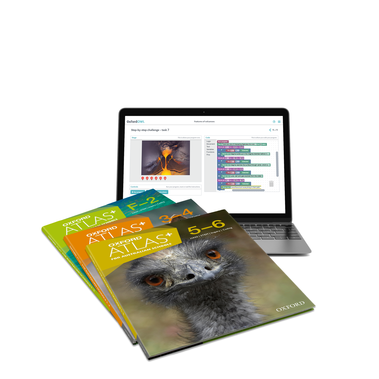
Oxford Atlas+ is more than just a traditional atlas series. It provides comprehensive coverage of the Science and Humanities and Social Sciences curricula for Years F–6 across a suite of print and digital resources. There is also targeted support for the Technologies curriculum, including coding.
Oxford Atlas+ is the only differentiated atlas that caters to early, middle and upper primary students and is the only atlas series that offers students digital access to rich interactive content.
Oxford Atlas+
for Australian Schools
The atlases:
- teach essential map-reading skills and feature world, continent and country maps
- contain high-interest topics explicitly linked to outcomes in the Science and HASS curricula
- use practical, inquiry-based activities and experiments to teach topics and to develop students' critical thinking and problem-solving skills
- are accompanied by a wealth of resources that support the Technologies curriculum, including coding interactives and unplugged activities designed to develop authentic design solutions and computational thinking across different subject areas.
Table of contents:
| MAP SKILLS |
|---|
| Mapping our earth |
| What is a map? |
| What is a legend? |
| What is direction? |
| What is a grid? | What is scale? |
| Introducing my world |
| My room |
| My house |
| My street |
| My neighbourhood |
| My city |
| OUR WORLD |
| Sun, Earth and Moon |
| Seasons and weather |
| Natural environment |
| Living things |
| Life cycle of a frog |
| Endangered animals |
| Water on Earth |
| Caring for the environment |
| Our amazing senses |
| Push and pull |
| Places from the past |
| Australia's first people |
| My family tree |
| Families |
| Remembering the past |
| Houses of different materials |
| Food from different cultures |
| Celebrations around Australia |
| OUR COUNTRY |
| Australia |
| About Australia |
| Western Australia |
| Northern Territory |
| South Australia |
| Queensland |
| New South Wales |
| Australian Capital Territory |
| Victoria |
| Tasmania |
| THE WORLD |
| The Pacific |
| New Zealand |
| Asia |
| Europe |
| Africa |
| North America |
| South America |
| Antarctica |
| Index |
| DISCOVERING MAP SKILLS |
|---|
| What is a map? |
| The map legend |
| Maps use direction and scale |
| Finding places on maps | Interpreting data |
| Different kinds of maps | DISCOVERING OUR WORLD |
| Sun, Earth and Moon |
| Day and night |
| Seasons | Changing Earth |
| Rivers change the land |
| The changing coastline |
| Humans change the land | Natural resources |
| Habitats in Australia |
| Australia's natural resources |
| Using our natural resources |
| Living things |
| Living and non-living things |
| Extinct animals |
| Life cycles | Heat |
| Hottest and coldest |
| Producing heat |
| How do we use heat? |
| Forces |
| Different forces |
| Speed and friction |
| Magnets |
| Fist people |
| Australia's first people |
| Indigenous sustainability practices | Arrival and impact |
| Exploration |
| The British arrive in Australia |
| Living cultures |
| Communities and celebrations |
| Communities around the world |
| Democracy |
| Multicultural Australia |
| Remembering the ANZACs | Discovering our country |
| Australia |
| About Australia |
| Western Australia |
| Northern Territory |
| South Australia |
| Queensland |
| New South Wales |
| Australian Capital Territory |
| Victoria |
| Tasmania | Discovering continents and countries |
| World environments |
| World countries |
| Pacific |
| New Zealand |
| Asia |
| South-East Asia |
| East Asia |
| South Asia |
| Middle East |
| Europe |
| Northern Europe |
| Southern Europe |
| Russia and neighbours |
| Africa |
| Northern Afica |
| Southern Africa |
| North America |
| Canada, Alaska and Greenland |
| United States of America |
| Central America and the Caribbean |
| South America |
| Northern South America |
| Southern South America |
| Antarctica |
| Map index |
| Subject index |
| EXPLORING MAP SKILLS |
|---|
| Observing the world | Reading maps |
| Using a legend |
| Different kinds of maps |
| Using direction | Using grids, lattitude and longitude |
| Using scale |
| Interpreting graphs | EXPLORING OUR WORLD |
| Our changing earth |
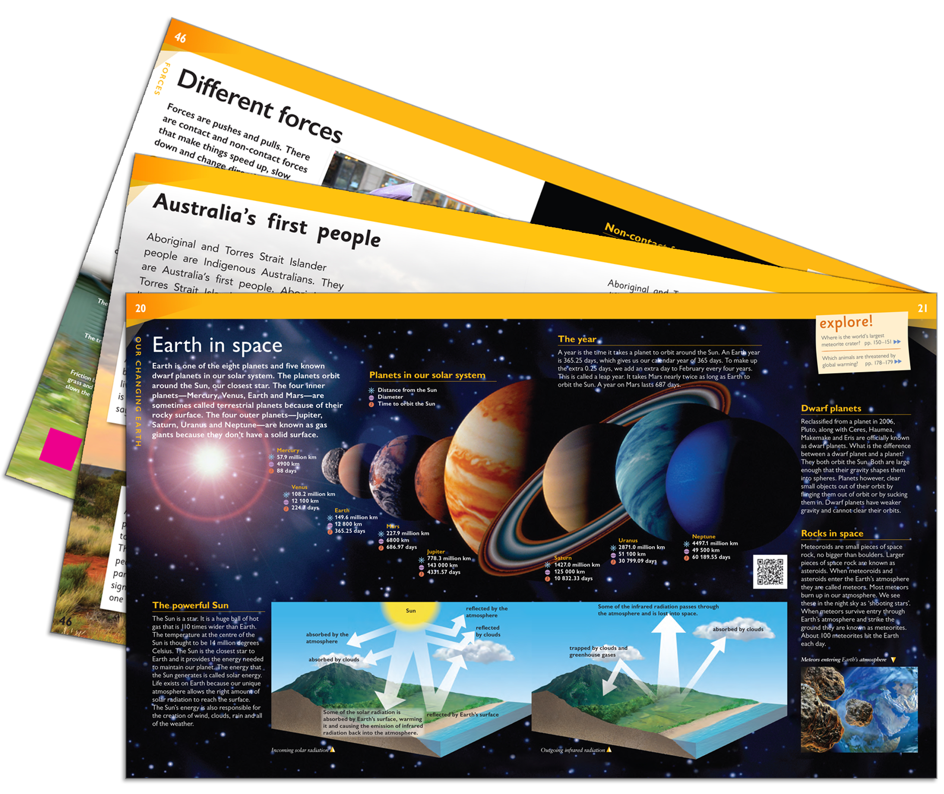
| Earth in space |
| Volcanoes and earthquakes |
| Managing natural disasters | Changing states |
| Changing states of water |
| The water cycle |
| Rainbows, light and colour |
| Water in oceans | Surviving in different environments |
| Animals and their habitats |
| People adapting to environments |
| Australia's climate and vegetation |
| Survival in Australia's deserts |
| Living in Australia |
| Where do we live? |
| How have places grown? |
| Living in communities |
| Caring for places | Using and conserving resources |
| Australia's minerals and energy |
| Renewable energy |
| Making electricity |
| Power in the home |
| Australia in the world |
| Australia and Asia |
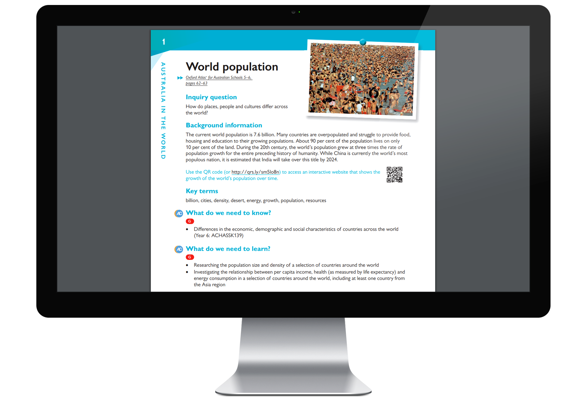
| World population |
| Contrasts in living conditions |
| Refugees | Australian colonies |
| First Australian colonies |
| Colonial settlement |
| Gold rush |
| Exploration | Australia as a nation |
| Federation |
| Population and migration |
| Indigenous rights |
| Government |
| Democracy and the law |
| Australian citizenship | A globalised world |
| Global citizenship |
| Being a consumer |
| Providing goods and services | EXPLORING OUR COUNTRY |
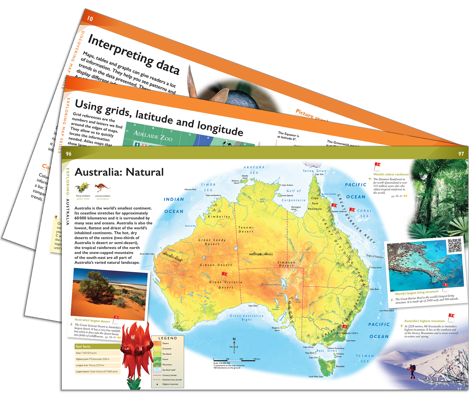
| Australia: Natural |
| Australia: Human |
| Western Australia |
| Northern Territory |
| South Australia |
| Queensland |
| New South Wales |
| Australian Capital Territory |
| Victoria |
| Tasmania | EXPLORING CONTINENTS AND COUNTRIES |
| World: Natural |
| World: Human |
| Pacific |
| New Guinea |
| New Zealand |
| Asia: Natural |
| Asia: Human |
| South-East Asia |
| East Asia |
| South Asia |
| Middle East |
| Europe: Natural |
| Europe: Human |
| Northern Europe |
| Southern Europe |
| Russia and Central Asia |
| Africa: Natural |
| Africa: Human |
| Northern Africa |
| Southern Africa |
| North America: Natural |
| North America: Human |
| Canada, Alaska and Greenland |
| United States of America |
| Central America and the Caribbean |
| South America: Natural |
| South America: Human | Northern South America |
| Southern South America |
| Antarctica |
| Arctic |
| World Statistics |
| Map index |
| Subject index |
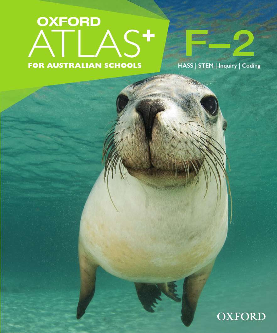
| Student Book | ISBN: 9780190310769 RRP: $43.95 |
|---|---|
| Student Dashboard | 9780190329464 |
| Teacher Dashboard | ISBN: 9780190310790 |
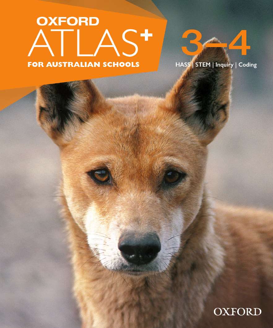
| Student Book | ISBN: 9780190310776 RRP: $43.95 |
|---|---|
| Student Dashboard | ISBN: 9780190310820 |
| Teacher Dashboard | ISBN: 9780190310806 |
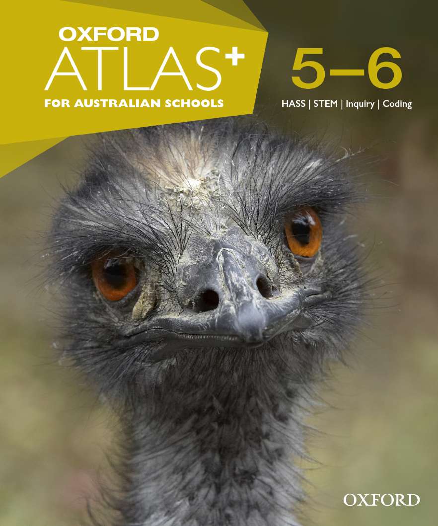
| Student Book | ISBN: 9780190310783 RRP: $43.95 |
|---|---|
| Student Dashboard | ISBN: 9780190310837 |
| Teacher Dashboard | ISBN: 9780190310813 |
Help your class navigate a crowded curriculum
Learn essential
map-reading skills
Mapping-skills pages introduce and explore essential map-reading skills.
Detailed world, continent, country and state maps include case studies to help students explore the world around them.
Cross-disciplinary coverage
High-interest topic spreads cover Science, History, Geography, Civics and Citizenship (Years 3–6) and Economics and Business (Years 5–6) content from the Australian Curriculum.
This integrated curriculum approach encourages students to be innovatative, creative learners.
Inspire your students with engaging digital content
Explore the world and build skills for deeper understanding
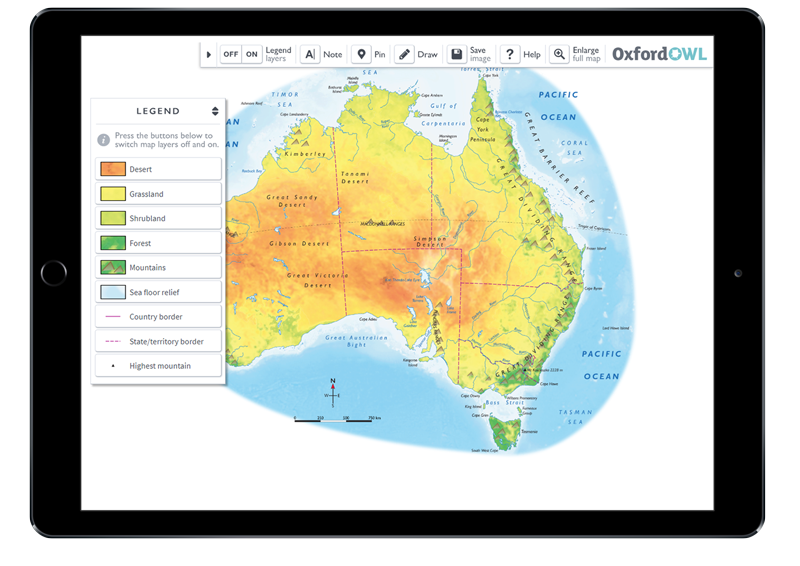
Interactive layered maps enable students to explore their world and understand the distribution of habitats, natural resources and other environmental features.
Mapping skills and topic interactives develop students' critical thinking and problem-solving skills while encouraging them to be creative learners.
Learn to code
Coding interactives develop students’ sequencing and computational thinking skills.
Visual step-by-step instructions make these activities easy for teachers to administer and students to follow (Years 3–6).
Experience unparalleled teacher support
Plan with confidence
Detailed professional support notes suggest activities, ideas and classroom experiments.
Explicit curriculum links enable teachers to deliver comprehensive coverage of the Science and HASS curricula for Years F–6, with targeted support for the Technologies curriculum.
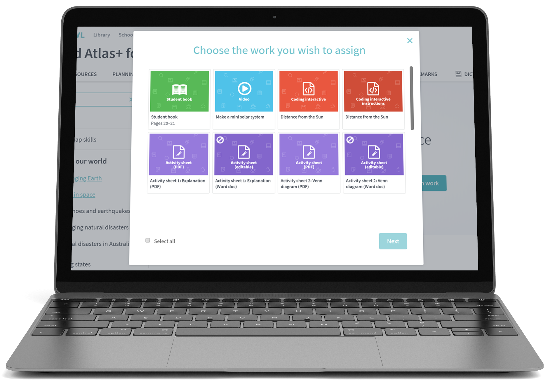
Assign work and instantly track student progress
Share atlas pages, assign quizzes and allocate activities to students directly from the Teacher Dashboard.
Evaluate student understanding and skill development with pre-assessment and assessment activities.
Instantly track quiz results and chart student progress online.
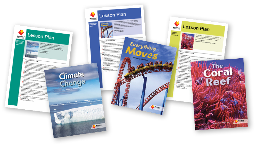
Extend STEM learning with WorldWise, a high-interest literacy program
Request a FREE correlation chart and explore how WorldWise aligns with Oxford Atlas+, and how both series map against the expected Australian Curriculum: Science learning outcomes.
WorldWise is a high-interest literacy program that supports a range of STEM topics linked to the curriculum. This series takes an inquiry and investigative approach to learning, teaching reading strategies simultaneously with natural, earth and physical science concepts.
| PURCHASE TYPE | PRINT STUDENT BOOKS | STUDENT DIGITAL DASHBOARDS | TEACHER DIGITAL DASHBOARDS |
|---|---|---|---|
| INDIVIDUAL PURCHASE |
Oxford Atlas+ F–2: $43.95 Oxford Atlas+ 3–4: $43.95 Oxford Atlas+ 5–6: $43.95 |
|
Individual purchase not available |
| CLASS SET (25+ COPIES) |
Price per book (as above) |
$9.95 per additional student for 24/36 months' access. |
Site license FREE for 36 months (F–2) and 24 months (3–4 and 5–6) (all teachers can access). Then $299.95 for access for the remaining life of the edition (site license, all teachers can access). |
| BOOKLIST | Price per book (as above) | FREE | Site license: FREE for the life of the edition (all teachers can access). |
Request your digital samples:
Complete this form to access samples from each of the Oxford Atlas+ Teacher Dashboards. The samples will be added to your Oxford Owl account. Don't have an account? One will be created for you.
REQUEST SAMPLES